ГЕОХИМИЯ, 2013, № 3, с. 266-275
КРАТКИЕ СООБЩЕНИЯ
CLIMATE FLUCTUATION RECORD FROM CHINA'S SALAWUSU RIVER VALLEY DURING THE EARLY LAST GLACIAL
© 2013 г. Si Yuejuna, Li Baoshenga, b, David Dian Zhangc, Wang Fengniana, Wen Xiaohaoa, Yang Yid, Du Shuhuane, Niu Dongfenga, Li Zhiwenf, Zhao Xinnang, Wang Jianglonga, Guo Yihuaa, Jiang Shupinga, Guo Yuanjuna
a School of Geography, South China Normal University, Guangzhou, 510631, China; E-mail: libsh@scnu.edu.cn (B. S. Li) b State Key Laboratory of Loess and Quaternary Geology, Institute of Earth Environment, Chinese Academy of Sciences, Xi'an, 710061, China; c University of Hong Kong, Pokfulam Road, Hong Kong; d Chinese Academy of Geological Sciences Institute of Geomechanics, Beijing, 100081, China; e Key Laboratory of Marginal Sea Geology, South China Sea Institute of Oceanlolgy, Chinese Academy of Sciences, Guangzhou,510630, China; f College of Earth Science, East China Institute of Techology, Nanchang, 330013; China; g Institute of global environmental change, Xi'an Jiaotong University, Xi'an, 710054 China
Поступила в редакцию 05.10.2011 г. Принята к печати 26.10.2011 г.
Keywords: Salawusu River valley, MGS4 segment, Early Last Glacial, grain-size, trace elements, climate fluctuations.
DOI: 10.7868/S0016752513030072
INTRODUCTION
The records of Heinrich events from the North Atlantic and Dansgaard-Oeschger cycles in the Greenland reveal the climate fluctuations on millennial-scale since the Late Pleistocene [1—3]. The instability of global climate was also recorded in the ice cores [4, 5], pollen [6], loess [7—9], stalagmites [10, 11] and marine sediments [12, 13], including many geological records for China's monsoon climate variations since 60 ka B P. However, few studies were reported in China for the climate fluctuations on millennium-scale from 60 to 75 ka B P. the Early Last Glacial is equivalent to the OIS4 that is the transitional cold period between Last Interglacial OIS5 and Last Interstadial OIS3. This study is to reveal whether climate fluctuations in the study area occurred on millennium-scale, and whether these fluctuations were similar to the Dans-gaard-Oeschger events recorded in the polar ice cores and stalagmites during the Early Last Glacial.
Located on the southeastern margin of China's Mu Us Desert, the Salawusu River valley has been regarded as a standard site for studying environment evolutions since the Late Pleistocene. In the 1920s, French paleontologist Teilhard de Chardin and his colleagues carried out the initial investigations and researches
within this area and characterized the fluviolacustrine sediments Upper Pleistocene Salawusu (Sjara—Osso— Gol) Formation [14—16]. In 1964, Chinese scholars Pei et al. [17] suggested the age of the layer on the top of the Salawusu Formation belonged to the Holocene, and the age under the bottom belonged to the Middle Pleistocene. In 1978, Yuan et al. [18] divided the Salawusu Formation into upper part and lower part, with the age of the Late-Upper Pleistocene and Middle-Upper Pleistocene. Dong and Li et al. [19, 20, 21] suggested that the upper part was mainly the aeolian sediment and named the Chengchuan Formation, and the lower part was the Salawusu Formation; the Chengchuan Formation was equivalent to the Malan Leoss [22, 23] and divided into three parts; the upper, middle and lower parts corresponded to OIS2, OIS3 and OIS4 of the Last Glacial, respectively [24, 25]. Based on the previous researches, we choose the MGS4 segment of the Milanggouwan stratigraphical section in search of clues for the regional paleocli-mate. By determining the ages and analyzing the grain-size, in combination with the analysis of trace chemical element contents, we attempt to understand the climate variations on millennium-scale during the Early Last Glacial.
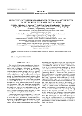
Fig. 1. The stratigraphical sequences and ages of the MGS4.
1 — Paleo-mobile dune sands; 2 — fluvial facies; 3 — lacustrine facies; 4 — paleosol; 5 — TL age
STUDY AREA AND METHODS
The MGS4segment
The Milanggouwan section is situated along the left bank of the middle reaches of the Salawusu River in a low-lying part of the southeastern Ordos Plateau [26], about 500 m northeast of Milanggouwan Village (108°33' E, 37°45' N). Since the Late Pleistocene, the south and north parts were subject to uplift and erosion, and the dune sands accumulated, fluviolacustrine and paleosols developed in the southeastern depression. In recent 2000 years, because of tectonic rising and river cutting effects, the Salawusu River valley formed [18], and the Quaternary stratigraphical sequences largely appeared along the banks, with the thickness of about 70 m, which contained stratigraphical sequences ofHo-locene-Upper Pleistocene and part of the Middle Pleistocene. The Milanggouwan section consisted of many sedimentary facies and was a representative stratigraph-ical section for current paleoclimate researches.
The MGS4 stratigraphical segment is a series of sedimentary sequences with depths ranging from 28.42 to 36.95 m, including a total of 11 layers from 50D to 60D (Fig. 1): six layers of aeolian paleo-mobile dune sands (50D, 52D, 54D, 56D, 58D, 60D), four layers of fluvial facies(51FL, 53FL, 55FL, 59FL) and only one layer of lacustrine (57LS). The dune sands are yellow-brown fine sand, loosely compacted and evenly sorted, the total thickness is about 5.84 m, of these, the bottom of 56D with occasional ferro-rusty
spots and level beddings, and the bottom of 60D with 0.15 m thickness of orange aeolian fine sands, probably the semi-fixed paleo-dune sands. The fluvial facies are dark gray to greyish yellow silty fine sand, with occasional plant relicts, roots and calcareous concretions and ferro rusty spots, with inclined beddings formed by water currents, the total thickness is about 1.9 m. The lacustrine is greyish yellow to dark green silty very fine sand, with calcareous concretions and boards, the thickness of 0.79 m. The data suggest that 5.5 sedimentary cycles consisting of the dune sands alternating with the overlying fluviolacustrine facies occurred during this stage, 50D accounting for only half a cycle.
Ages within the MGS4
We dated three layers by means of thermoluminescence (TL), including 50D, 54D and 60D in MGS4. To do so, we used quartz grains smaller than 10 ^m collected from the samples. The age determination was conducted by Lu Liangcai, using a Type 711 age determination instrument (Littlemore Scientific Instrument Corporation, Oxford, UK) in the TL lab of the Guangzhou Institute of Geochemistry, Chinese Academy of Sciences. The age for each sample and the relevant parameters are listed in Table 1.
Table 1. TL ages of some horizons and their parameters in the MGS4
Horizon-lab number depth (m) U (ppm) Tb (ppm) K % R a Equivalent dose (Gy) Annual dose (mGy) TL age (ka B P )
50D(TGD782) 28.42 0.78 ± 0.04 6.72 ± 0.13 1.94 ± 0.016 0.005 0 133.00 ± 9.98 2.26 ± 0.07 58.85 ± 5.80
54D(TGD783) 29.64 0.25 ± 0.01 7.17 ± 0.14 1.95 ± 0.016 0.004 0 152.00 ± 11.40 2.25 ± 0.07 67.56 ± 6.50
60D(TGD784) 36.95 0.11 ± 0.01 10.06 ± 0.20 2.10 ± 0.02 0.007 0 186.20 ± 13.96 2.48 ± 0.08 75.08 ± 7.40
%
99.99 99.9 99
90 50
10
1
0.1 0.01
54D
0 12345671234567123456789 10 O Fig. 2. The probability curves of grain-size in different sedimentary facies.
Analyses of grain-size and trace elements in the MGS4
We collected 171 samples at an average interval of 5 cm (a few at intervals from 3 to 6 cm) in the MGS4 segment of the Milanggouwan section. The grain-size analysis was performed using a Malvern Mastersizer 2000 M analyzer in a measuring range of 0.02 to 2000 ^m, in Sediment Analysis Laboratory in Department of Geography, South China Normal University. The experimental procedure was based on that of the loess grain-size [27].
A total of 43 samples for trace chemical element analysis were collected at an average interval of 15 cm in the MGS4. The experiment was performed by Sun Zhong at the Central Laboratory of the Cold and Arid Regions Environmental and Engineering Research Institute, Chinese Academy of Sciences, Lanzhou, China, using an X-ray fluorescence spectrometer (Type 3020, Japan).
RESULTS AND ANALYSES The grain-size analysis
We summarize the means and range of values for the grain-size in the MGS4 segment in Figure 3. Based on these results, we can discern the following characteristics for MGS4.
The MGS4 segment mainly consists of the sand, with the sand accounting for over 90% in most of the samples. Of these, the highest fine sand contents range from 13.67% to 80.03% and average 57.93%; the second highest very fine sand contents range from 1.04% to 39.68% and average 15.38%; the medium sand contents range from 0 to 48.18%, averaging 19.13%; coarse silt ranges from 0 to 38.9%, averaging 4.99%; clay ranges from 0 to 8.72%, averaging 1.23%; coarse sand ranges from 0 to 8.38%, averaging 0.70%; and fine silt ranges from 0 to 4.09%, averaging 0.63%.
Table 2 shows the grain-size similarities between the paleo-mobile dune sands and the surrounding modernmobile dune sands, both of them mainly consist of the sand [28, 29]. The contents of coarse sand, medium sand and fine sand in the aeolian facies are higher than those in the fluvial facie and lacustrine facies, however, the contents of very fine sand, silt and clay in the fluvial and lacustrine facies are higher than those in the dune sands. Because of the grain-size differences between the dune sands and fluviolacustrine facies, the graph of these values over time shows considerable oscillation in the values between layers (Figure 3).
We made the chart of probability curves for grain-size of the MGS4 in Figure 2. The curves differ among the sedimentary facies. In the paleo-mobile dune sands, they mainly appear "one-line" mode (only saltation), but some with "two-line" mode (saltation and suspension) or even "three-line" mode (two saltations and a suspension), the curve slopes range from 66° to 73°, t
Для дальнейшего прочтения статьи необходимо приобрести полный текст. Статьи высылаются в формате PDF на указанную при оплате почту. Время доставки составляет менее 10 минут. Стоимость одной статьи — 150 рублей.